Wednesday, August 11, 2010

Hanging out and having fun in Colorado

We have been staying at Blue Mesa Ranch Resort, a Western Horizon resort in Gunnison Colorado. Fancy name for a large RV park. Every Saturday those that want can set up and sell products they have made or purchased for resale.

We set up a table like many others and tried to sell some of Dick's jewelry and polished stones. The first item that he sold was his first wire wrapped project that he made. The next Saturday he sold a pair of earrings. Not the best place to sell higher cost jewelry. We did have fun and while sitting there he made some more pieces to sell and Jackie made some cards (not ready to sell them yet).

Another day we packed up and headed to town for a river rafting trip down the Gunnison river. Kind of mild but it was a great day until it started to rain. It cooled down fast and we got a little wet but had a great time.

Found some more places where the wild flowers came out in bloom and just had to stop and get some shots of them. This was just a small garden at the RV park but with carefully adjusted shot he was able to not get the road or fence in the picture.


Back doing family research Dick found that his Great Great Grandmother was buried in a very small mountain town in 1883. On the trip up the mountain we found a beautiful reservoir. This is in the Taylor Park area near the town of Tin Cup or Tincup.


The cemetery at Tin Cup is several knolls, each for different groups (Protestant, Catholic, Jewish). The only information we had was that she was buried in the Protestant cemetery, the grave was in the second row near the middle and at one time it had picket fence and a wood grave marker that are now gone.
You have to cross the bridge to get to the cemetery.


The trees have grown up throughout the area and it was very difficult to determine what the rows are. Based on what little information we had this was the grave site we picked to be hers. We put flowers on the grave and departed in the rain.

Hope we got the right one, but will never know for sure.
A few miles away, the family settled in an area called Union Park on 20 acres in the middle of this valley and extending into the forest on the right.

This building was there about the time that the gold mining was going strong in the area and is still used as a cow camp.
Hope to go back another time now that we know the exact location of the Texas Placer mine and see if there is any indication of a home where she died.

Another day another trip up into the mountains. This time it was to an historical RR tunnel at the end of a road. The road to Alpine tunnel is the old narrow gauge track bed that gains several thousand feet up the side of the mountain.
This is a view down the valley at only about half way to the top.


The rock retaining wall was put in around 1880 and still holds the road in place. That clear strip on the right is the same road.


Not sure what is around the corner but glad no one was there when we went around the bend. Notice it is straight down with room for only one vehicle.

On the way up there is a restored water tank. One of several but the only one that has been restored.


Half way up the mountain some of the track still stand, but this is a siding where a town once stood. If there was not a sign here one would have no idea of what was here over 100 years ago.


Finally at the top the remains of several buildings and the restored station and one other building. While there we found two people working on restoring the large stone building on the left.
The tunnel is still there but a rock slide has closed it off at both ends. It was only in use from 1881-1910. Must have cost thousands of dollars to build the tunnel and the RR to only be in service for that short time.
Did we mention that it took us 1 1/2 hours to travel the 10 miles to the tunnel?


On the way back home we ran across the Indian in the side of the hill.


Looks like he is looking over a ranch and the valley.


Stay tuned for more of our travels.

To be continued...

Sunday, August 1, 2010

First stop in Colorado

Lets see if we can figure out what all these pictures are; it's been awhile since we visited these areas of Colorado. In our last posting we told you we are in a hole as far as Verizon is concerned so yesterday we took a ride to a little town up in the mountains and found a good hot spot so we were finally to able get the pictures uploaded. Sorry about the delay.

After setting up in Fruita Colorado at a very nice but over-priced State Park we checked out town and the local visitors center for information on the area and all of Colorado. We ended up spending 4 nights here but it was still over 100 every day so up to the mountains we went where it was a little cooler.

Just up the road from us is the Colorado National Monument (more red rocks). It was impressive, but after all we've seen in UT & AZ, not the best. There is a loop road, about 35 miles that goes up to the top, across and down the other side into Grand Junction.


We did stop at the visitors center, saw the movie about the Monument, checked out the campground, stopped at all the lookouts and walked some of the trails.

Not sure how far it is to the bottom but it's too far for us old timers to try and get there (and back!).


Looking North down to the town of Fruita, if you look closely, just on the other side of the river, you can see our rig at the State Park. Let us know when you find it.


Just another shot of Monument showing how close it really is to town. Kind of a hazy day so not
the best shots Dick has taken. Looking across the valley is the Grand Mesa National Forest, and yes, we have some pictures of that. Keep looking.

We started at about 4500' of elevation and kept climbing and climbing to over 11500', and what a view from the top. When we took this picture looking at China in the distance we still had not arrived at the top!


The temperature went from 100+ to the low 60s and everywhere you looked were mountain lakes. That funny strap on Dick's back is his camera strap. Notice that this is the first time in months that we have had to put on jackets. Glad we had them stowed in the truck for just this situation.


We still had shorts, but think that's about all we wear. Jackie and C C enjoying the view of more lakes.


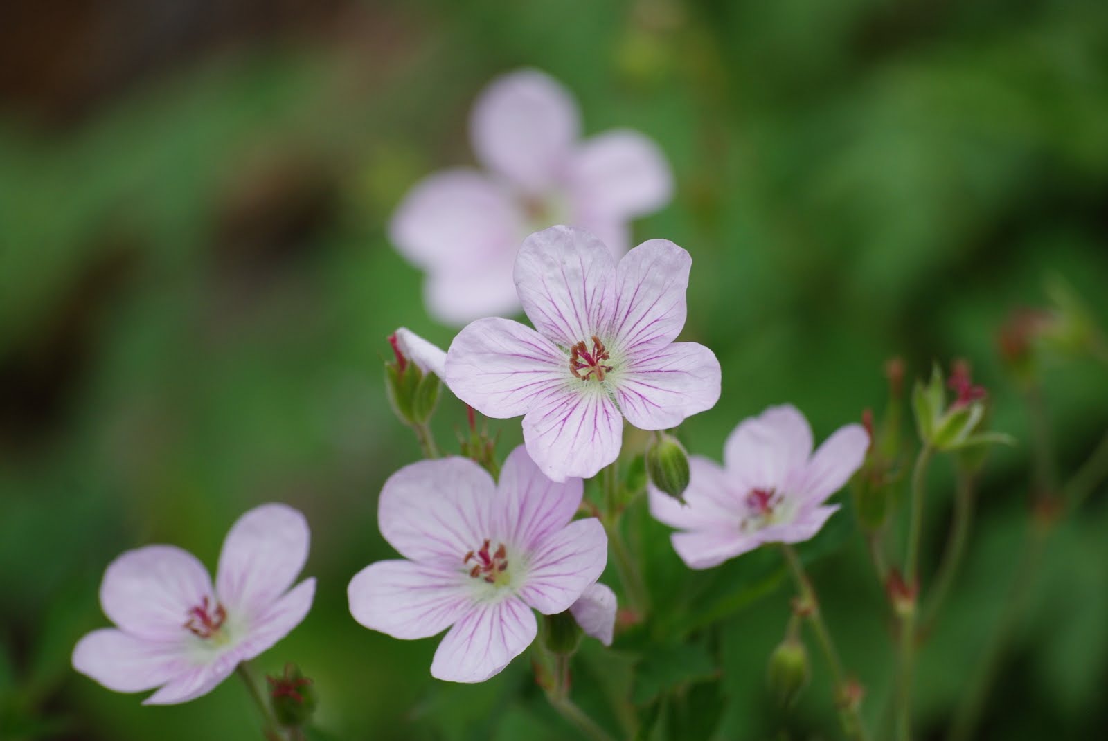
On the hike to the viewpoint Dick had to stop and shoot some of the wildflowers. So very delicate with the purple lines in the petals.


Hard to see in this shot but the mountain meadows were full of various colors of wildflowers.


A little closer look.

Not sure how this picture got out of sequence but this is Jackie seeing how close she can get to the edge back at Colorado National Monument. (Notice, she's not very close--not nearly the daredevil Dick is.)

Rather than take the paved road back down from the National Forest we found an old one lane gravel switchback road that took us to the bottom that you can see off in the distance. Now we know why they call this "Lands End Road". We do this a lot, sure glad we have a 4WD truck with good brakes as this was about a 7000' decent. Then when we were almost down we came across a winery, so of course we had to stop and rest and check out the product. It was very good and we ended up buying a couple of bottles. (This is for Marie and Pat -- they'll understand.)

We are still at Blue Mesa RV Ranch in Gunnison so I guess this area will be our next post, so..


to be continued...

Wednesday, July 28, 2010

Colorado for a few weeks...

We finally made it out of Utah and are now in Colorado until we decide it's time to go to Wyoming. We spent 4 days at Grand Junction and then moved to Gunnison where we are staying now at Blue Mesa Recreation Ranch for about 17 days.

We have tried several times to post pictures but we are in a valley between two large hills so do not get very good Internet connection. We have pictures of Colorado National Monument and the Mesa National Forest at close to 11,000 feet to share. Please be patient and we will get going again soon. We will just have to take the computer to town and get them posted for you.

If you want to reach us please send us an email and we will find a hot-spot and give you a call.

So for now we sill sign off only...

...to be continued

Friday, July 9, 2010

Still in Utah

Another day another day trip to see more of southern Utah. This time was to Coral Pink Sand Dunes State Park where most of the sand is blown in from more red rocks. There is a pink hue to the sand but hard to photograph.

Most of the park was set aside for playing with 4 wheel rigs like the Oregon coast dunes but a small part was set aside for walking. There was a nice half mile loop, hard walking, but nice views with lots of descriptions of the plants there.

A minute after taking this shot about 10 buggies came roaring over the top of the dune. Looks like fun but sure breaks up the silence of the park.

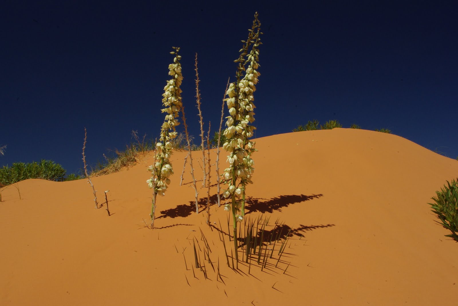
Not sure how the Yucca plat continues to survive as it is buried completely under the sand except for it's flower.


Wow, yellow flowers growing out of the dunes. Must not need much water as there isn't much here.


The winds keep moving the sand over this dune so nothing is growing here.


Pink, green, yellow and blue add a unique color pallet to this photo combined with the slope of the dune caught Dick's eye.

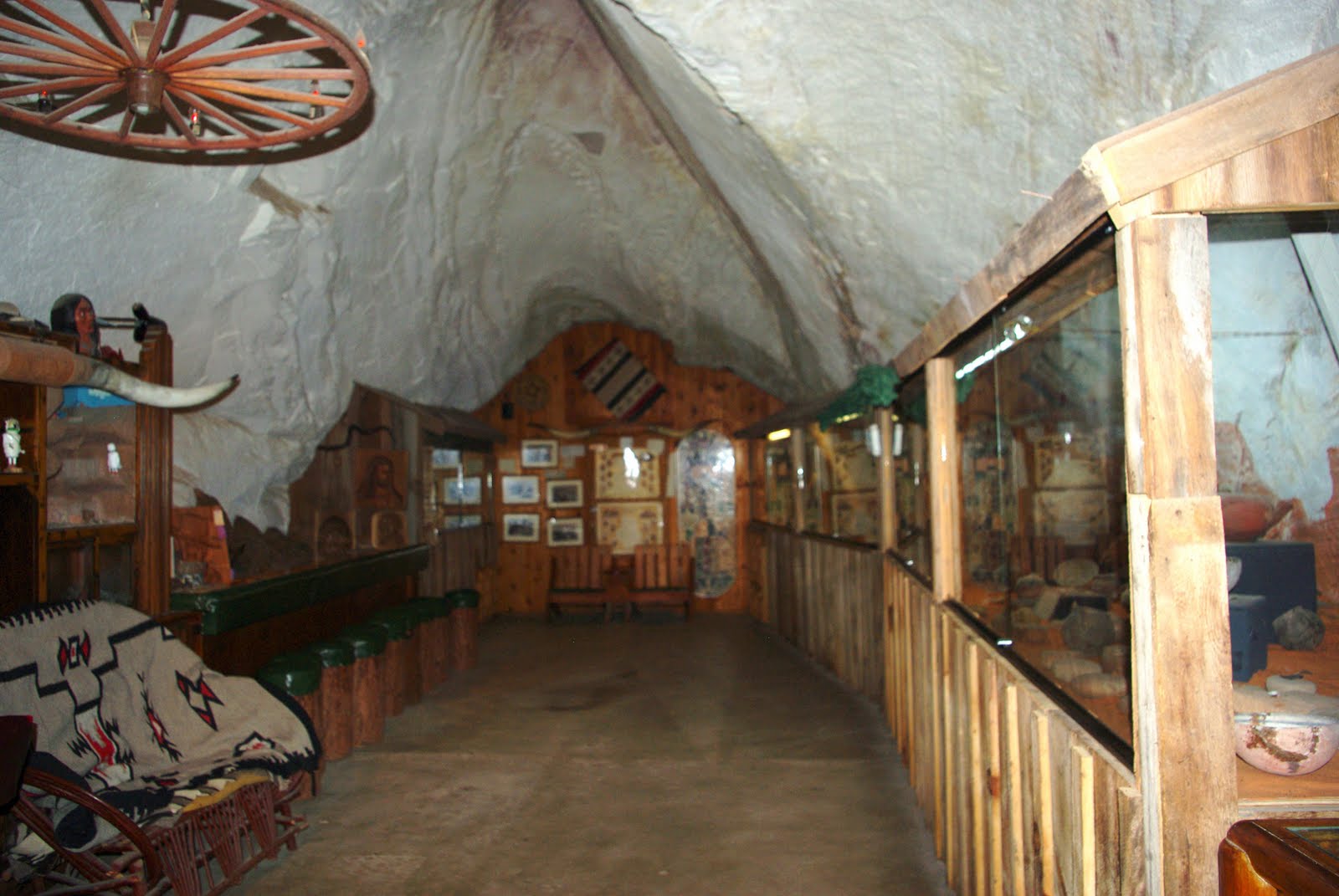
On another day, a few miles down the road just outside of Kanab there is an old cave that was used in the late 1800's and early 1900's as a gathering and party place for the local kids. It was purchased by a Mormon family who cleaned it up and turned it into of all things a bar and dance hall in the 1950's.
After 25 years of drunks and fights the owners closed it down and turned it into a tourist spot with a museum and gift shop still operated by family members. The original owner had quite a collection of artifacts, native American, rocks, and dinasaur tracks he had collected all over the southwest.
The entrance was revamped with stone and glass with exterior walls to add some southwest charm to the exterior.


A closer look at the entrance shows the fine detail that was added to an old cave.


The cave is all natural except they added dirt and cement to give a level floor and painted the ceiling to cover the graffiti from years of abuse. We could only see 3 large rooms and not sure if there was more. Looking into one section of the museum with lots of Native artifacts.


And another day we drove the 80 miles to Cedar Breaks National Monument. It was over 10500' of elevation and what a welcome relief going from 105 to 65 deg. temperature, and yes, we brought our sweaters. The drive up there was beautiful and included checking out a private campground on the river. Driving from 4000' to over 10500' and back, we saw many different landscapes, all beautiful.
This area to us was a little like Brice Canyon but still very unique and beautiful. Did we mention that the white you see here is.... yes it's snow.
It's interesting how the forest comes right to the edge of the canyon.
We had a lovely lunch (packed earlier in the day) at the picnic area by the campground. We were able to take CC with us this time as it was cooler, and she enjoyed watching the wildlife (deer, squirrels) while we ate.


Just another view looking deeper to the bottom.

Wish we had the time and youthful energy to hike and camp down at the bottom but maybe during our next life time. (smile)


More snow and hoodoos to tweak your imagination on how they are formed. Do love our new lens.


To be continued...

Friday, July 2, 2010

Bryce Canyon National Park with new glass

While here at Zion we have now made two trips to Bryce Canyon National Park, about 80 miles away and still want to go back but will save that for another trip back to this area of the country.


We hiked the rim trail and every few steps had to stop so Dick could take more pictures. This Park must be one of the most beautiful places on earth. This is one of the first pictures taken during the first stop on the trail.


A warm day, blue sky and fluffy clouds give a backdrop to the red hoodoo's that fill the canyon.


A little closer look will show some of the trails down in the valley.


You will have to blow up this picture to see the hiker in the lower right just about ready to go through the arch. This gives you some idea of the scale of the area.


Had to get a shot of the two of us again standing on another edge.


A view of the hoodoos through an arch in the upper layers of sandstone.


Another area of the Canyon but showing the amount of erosion at the top of the rim. Like the Ranger said "the seed for the tree was not planted 18" above the ground. We find it amazing that trees can continue to live with their roots exposed like that.


Dick finally ordered and received his new glass (lens) for his camera and has been trying different things with it. Today was the first time that he was able to get out in the field and take some pictures with it.


The new lens is a Sigma 70-300mm, F4-5.6 fully automatic with Macro. The next shot of a hoodoo was taken at 70mm, and...


showing the trees growing at the top at 300mm. Just like you are sitting there.


Here are some of the last shots for the day using both lenses. The old lens at 18mm. Can you see the two little trees on the top white rock in the center?


Now lets zoom again with the old lens to 55mm.


With the new lens set at 70mm...


and finally at 300mm, a little overexposed but you get the picture (pun intended). Dick has also used the new lens shooting wild flowers and wild game here at Zion but will have to save that for another time.


I must say this was the most difficult series of pictures to just pick out a dozen or so to share because there are so many awesome shots that Dick took. That new lense is just so fun!!!


Are you getting tired of red rock yet? We aren't. In fact, when we came back into Zion after the trip to Bryce, we both commented about how beautiful the trip is (even with the road torn up and very uncomfortable!).


On a closing note please be advised that we have locked this blog from receiving direct comments due to spam from a foreign country. Please continue (or start) to leave comments and one of us will have to approve it before it gets posted.


Thanks for understanding and...


to be continued...


Saturday, June 26, 2010

Working again...

About the 9th of this month while staying at Hurricane Utah we decided to visit Zion National Park here in Utah. While there we had to check out the campground. We stopped at the kiosk and found out that they were looking for a camp host as the second one had a medical emergency and could not make it here. We talked to the host and their boss. We negotiated with them that we would stay and host for 5 weeks; they wanted us for 2 months, but we said no.

Two days later we pulled into our site next to the other host, set up the rig, spent one day in training and then started a 3 day on 3 day off cycle.

This is just a shot of the front of our site, the back opens out to a huge sitting area with a nice fire pit and trees. Notice the view we have out our back window.


And the view we have looking out our side window and sitting area. We have about 6 deer that come by and check us out most nights. The hosts that we share the duties with are both great and fun people that have been working here for several years so know the ropes.

There are about 170 sites in this campground with power to about half of them and it's 100% reservable and we don't have to handle any of the reservation. The second campground is all first come first serve.

The third day here we hiked up a short trail and the water seeping out of the rocks was from rain that came down over 1000 years ago and took that long to get to this area of the rocks. All the vegetation was growing out the side of the rocks with no soil.

Another hike, another view of the park, red rocks and white rocks, typical southern Utah.


Looking down the Virgin river that has cut it's way through the park for thousands of years.


Another view at the upper end of the canyon with a couple sitting on the beach.


End of the trail for walking on the path, from here up it's hit the water and walk what they call the "narrows". It was closed at this time because of the amount of water still running in the river. It's open now but we hear on the radio about every day of people getting stuck trying to get back down, or injured because of the fast moving water.
We have not tried the hike yet but plan on it before we leave, have talked to people that have gone up a mile or two and made it back with their family.


Another hike on a day that it only got into the 80s, now it's up to 105 in the days and 70 at night. We spend the afternoons inside and can sit out in the evenings until 10:00, then it's bed time.


The east side of the park the geology changes drastically from loose rock to slickrocks. This is called checkerboard mesa. And you can see why with the line horizontal and vertical.
The white flower is growing from the small Yucca plant.

We took the Watchman trail one day and this was just the start. From here it went up and up above the tree line across the side of the hill.


A view from the top looking across Zion Canyon. What a view, the only problem was that we hiked up most of the trail in the shade but for some reason the sun moved and we had to come back down in full sun. It was another hot day.


And looking up the Canyon with some of the park housing below.


To be continued...