Tuesday, July 5, 2016

End our tour at Capitol Reef National Park Utah

We just finished our last day as camp ground hosts here at Capitol Reef National Park and we will be out of here heading to Prove Utah on Thursday the 7 of July.  But before we go I guess we should post some more pictures of the Park all taken in the last two weeks or so.

We hope to get the engine on the motor home serviced on Friday and maybe spend the weekend in Salt Lake City and then into Wells Nevada and the Ruby Mountains for a couple of days.

Hope you enjoy.

Our campsite for the last four months taken today


One of the Apricot orchards ready to pick this week.
 
 
Another view from our camp site.
 
 
Waiting for the sun to drop below the clouds.
 
 
Here it comes.

 
Just about ready to set.
 
 
Just more beautiful natural formations


We went camping last week for a few days to a National Forest site and woke up one morning to this guy standing outside our rig just daring us to come out and play.


To be continued...


Tuesday, June 21, 2016

Fish Lake vacation near Loa Utah.


Our schedule as Volunteers here at Capitol Reef National Park worked out that we had 6 days off in a row so we decided to find a place that was a little cooler.  We headed to Fish Lake about 50 miles from the Park and 3,500 feet higher in elevation and in the mountains above the little town of Loa here in Utah.  We made reservations at Doctor Creek park that we found out later was not needed as only about half of the camp sites are on the reservation list.
 
If you can find the little arrow you can find our rig in the campground.


This little guy greeted us on our first hike around the end of the lake.
 
 
After spending the last 8 months in the desert it was fun to take a road trip and see all the green trees and the snow still in the mountains above us.
 
 
Same area but with a pond formed by the snow runoff.
 
 
A rock in a field of daisies or a field of daisies with a rock in it.  Not sure what the flower was but it looked kind of like daisies to us.
 
 
The forests in this area are made up of predominantly Aspen, and wish we could see them in the fall but will be long gone by then. 
 
 
There was hardly an area that we ran across that didn't have names carved on them.  This one took the cake for the longest list of names.  Must be a good Utah family.
 
 
And then you can find an artist in the crowed or one that could not spell and had to resort to family pictures.
 
 
Another day and another road trip up into this mountain meadow over 10000' and looking down over the road we came up
 
 
The only problem was that when we hit 10,500 we also found that it was the end of the road for us on this day.  We might have been able to get over this snow bank but if we had to turn around further down the road there was no way we could have climbed back over it.
 
 
And yet another day we took a back country road trip to the top of the mountain across the lake from where we camped.  It got a little tight trying to get to some of the overlooks but we made it.
 
 
At one of the lookouts at the top of the mountain out walked this lady from a small trail.  Dick asked her if she was walking around the lake and when she answered yes we were both shocked.   We sat and talked to her for several minutes and came to find out that the resort across the lake was owned by her son so Dick got this shot for her, if she remembers to email us.
 
 
To be continued...


Wednesday, June 1, 2016

Various pictures in Capitol Reef National Park in Utah

We have now been here just a little less than 3 months with one more to go until we finish our trip North to Washington State.  Below are several pictures shot all over the Park to share with those who want to go here in the future or can't make it at all.  Please enjoy as we continue to share more blog postings over the next month.  Maybe we will post a blog showing pictures taken outside of the Park.
 
Several people walking the wash to the Pot Holes
 
 
Twin rocks on Hwy. 24 west entrance

 
Chimney rock

 
Just some of the beauty from mother nature around the Park

 
Jackie in the shade near one of the Pot Holes waiting for Dick to find his way back

 
Volcanic rocks about 3' diameter sitting in the bottom of a wash waiting for the next rain.

 
The dirt road at the end of Scenic Drive

 
A view on the east side of the Waterpocket Fold (a big high rock formation)

 
The road that climbs over the Waterpocket Fold.  Straight up with lots of switch backs.

 
Not sure how Mother Nature does this to the red rocks but we both think it's beautiful.

 
Just for fun here are two cute shots of Dick's.
This one is called "One down and the other taking a ride"
 
 
For those that can't read the sign it says "Please don't feed the horses"


To be continued...


Monday, May 23, 2016

Utah Highway 12 from Torrey to Escalante

Today was another road trip day.  This one was from Torrey to the Town of Escalante.  The trip over Utah 12 with all the side roads took us all day and it was about 150 miles round trip.  To get there we had to climb to an elevation of 9600 feet with numerous grades up to 14% with several hills in the 8 and 10% grades.  This trip was just a very small part of the Grand Staircase-Escalante National Monument.
 
This is a typical view while traveling on Hwy 12, some red but mostly a lighter color stone.


Another area with more Utah red with some of the spring green showing.

 
A view of Calf creek downstream from the campground of the same name.

 
If you click on the picture and enlarge it you can see on the far side of the creek the hiking trail.  You  can see at on the bottom of the picture a critter trail. 
 
 
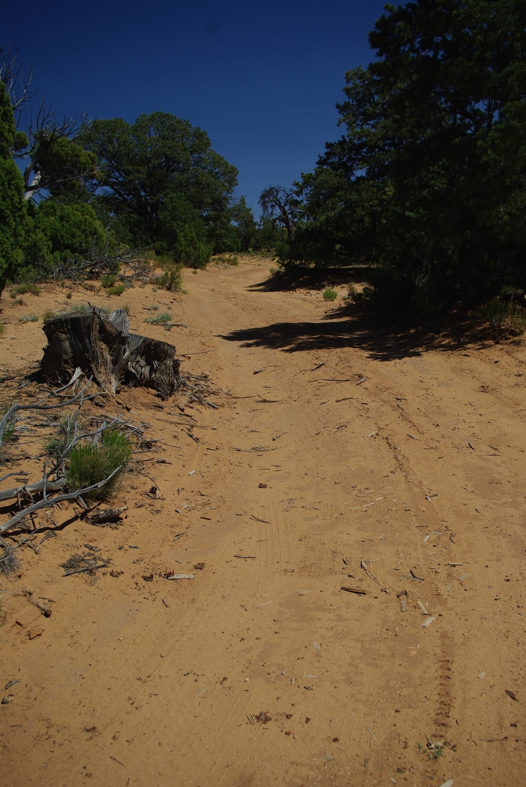
We found a back country dirt road that called us to see where it went.  Thinking it went back to the highway we kept going and going until it came to an abrupt end out in the desert.  We saw what could be an interesting rock formation so it was off on foot to see what we could find.

 
After a short hike we found what was a very unique formation.  Dick sent Jackie up to stand between two of the columns.  This is as far as he could get her to go, until he got closer and...
 
 
...looking through the columns we realized that it was about a 1000 feet shear drop off.
 
 
This is another one of those shots that it's very hard to shoot and see such a huge area and how much lower it is than where we are standing.

 
Way down below you can see where the river has turned some of the area to a green string across the rock hills.
 
 
Yes Dick is sitting on the edge of a 1000 foot drop off into the huge valley below.
 
 
On the way back to the truck we ran across this dead Juniper tree.  We have seen lots of Junipers but think this is the largest we have ever found.
 
 
While in the town of Escalante we ran across a house where the owner has made a scale model of a mining town to share with the local children.  While taking some pictures the owner came out to visit with us and share the history of his property.  Then he took us thru his yard showing us all the old historical items he has collected over the years.
 
 
This is a original hand cart that a family pulled and pushed across half the Country to get to Utah.  He had to cut off most of the handles to fit into his display area.  Along with the cart were numerous pieces of old farm implements. 

 
His yard was also filled with rocks that he has collected for most of his life.  He has no idea what the rocks are only that if he liked it he brought it home to set out in his yard.  We spent an hour walking with him as he shared his life time collection of history.
 
To be continued...