Friday, August 31, 2012

Another death-defying road trip

 
Not sure why all the pictures uploaded from the end to the start of this Blog but lets try and make the best of it.  Still in Colorado at the time they were taken.  We had heard about an old road in the National Forest where there was a lot of dispersed camping so we decided to go take a look.  Jackie found the road on an atlas and it was only 25 miles long.  That 25 miles took over 3 hours and we are glad that the Jeep is 4WD or we never would have made it.   It was a beautiful day trip in an area where we definitely want to do some more exploring.
 
Now remember we are going backwards so this is the last picture of the day heading the 85 miles around the mountain on a paved highway.  The sun is just setting on the top so no reflections on the water flowing from the top of the valley to the bottom.
 

Our last pull-off was just a few miles before Silverton Colorado where Dick got some good shots of Red Mountain or what is left of it after years of mining in, on and around it.


We had to make another stop on the way home and a kind gentleman offered to take our picture.  How could we say no when we are such a cute couple?!  Did you notice matching tee shirts and jackets?


This is one of the shots at the top of the mountain at 11,363'.  We either turn around and go back taking about 2 hours or continue down the other side for another hour and then do the 80 plus miles.  We opted to continue over the top and see what is on the other side.


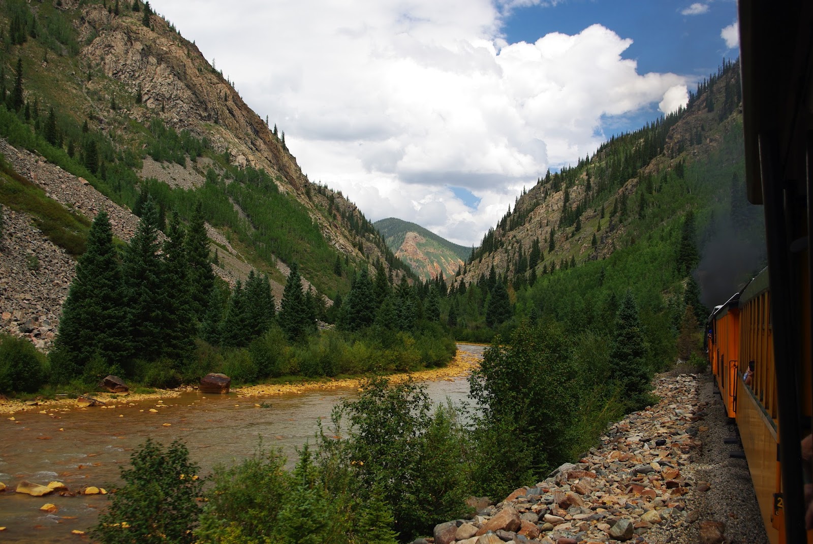
Just a typical view as you come around a hairpin curve, all we could say is "WOW".


At the top we found this lake in a meadow with several hunters camped in the area.


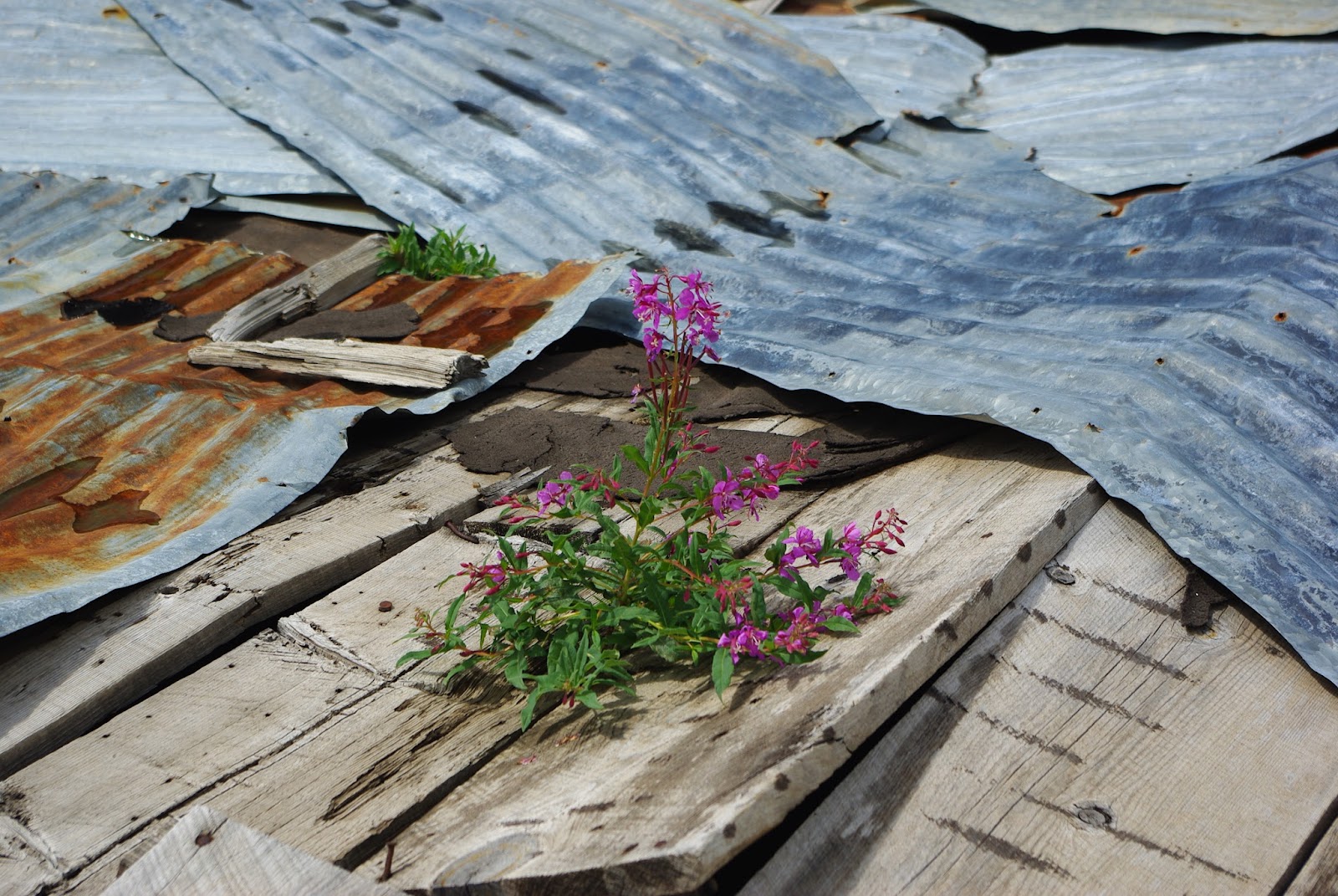
Near the top was an old mine with the remains of a fallen cabin that had a tin roof and not sure how this wildflower got through it all.


The first few miles was just a dirt road and then it started straight up and turned into nothing but rocks, we had to go side to side to miss the big ones sticking up.  What a challenge.


This is the miners cabin near the top next to the old demolished one in two pictures before this one.


On the way up we found an old campsite on the top of a bluff looking straight down.  What a great place for lunch.


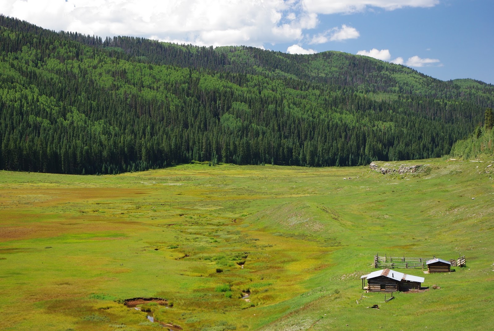
A Colorado Park with an old cabin and corral that was built years ago for moving cattle from New Mexico up to Colorado that has been restored.


Really hard to see but this was one of the places that Jackie had to get out and direct Dick how to get up the rock wall and not go over the edge.  The section is solid rock with about an 18" step at the bottom so Dick had to go to the right with 2 wheels about 18" higher and the right two wheels on the loose dirt.  As you can tell we made it (but it was really scary).


Like I said the pictures are out of sequence but this is another shot of where we sat for lunch.


To be continued...

Wednesday, August 29, 2012

Durango to Silverton Colorado

 
While trying to figure out our next stop after New Mexico someone told us we should see Durango Colorado so Jackie found a great campground on a little lake in the trees at about 8000' elevation where it is nice and cool.
 
Lake Haviland Forest Service CG with 50 amp power at a few sites but no water or dump.  Our first few day we tried out the solar for the first time but had to use the generator because of clouds and a power hungry refrigerator.  We extended our stay and moved to a site with power and that is working well for us.  The CG is about 18 miles north of Durango and the power sites are booked well in advance.


We have spent two days touring the lake with our little boat.  People are fishing all around and in boats and we saw a few fish caught.


On another day our Tour Director, Jackie, got us set up to take this narrow gauge train from Durango to Silverton in an open gondola.  It is about a 42 mile trip that takes about 3 1/2 hours each way.  Some people take the train up and ride a bus back.    


Getting ready to leave Durango in one of the open cars.  You have a choice between the cheap seats or sitting inside a car with small tables and food and beverages served.  Of course we took the cheap seats--how else could you get the views and pictures?

Off we go heading North and up, it was a cool morning so we had sweaters and shirts to be shed later.


They warned us not to stick our heads out the side to get pictures without checking what is ahead.  Several places you could pick the wild flower growing in the rocks.


We followed the river most of the way up and here we crossed over it again.


We had to stop for water twice going up and I think once on the way down.  We also stopped to drop off and pick up hikers and fishermen along the way.


Pumping out the black soot and smoke.  Had to wear glasses to keep it out of our eyes.


Finally arrived in Silverton, an old and small mining town turned into another tourist trap but a fun little town.


We had about 1 1/2 hours for lunch and a short walk around town before boarding for the the trip back down the mountains.  While there they turned the train around so we would see the view from the other side on the way down.


The track on this ledge was about 18" from a free fall to the bottom.  And it's a long way down.


It got cloudy on the trip down with a little rain.  We think there was the engine and about 11 cars and we were 4th from the back so you can see this is a pretty sharp curve.


Our last shot as we are about 1/2 hour out of Durango watching the sun creep up the side of the mountains into the clouds.  What a beautiful trip!


And tomorrow is our last stop for a month at Arches National Park in Utah.  Checked the weather and it's high is about 95 and we will be without AC, at least for the first couple of days.  Wish us luck.

To be continued...

Friday, August 17, 2012

Tent Rocks National Monument New Mexico

We finally departed Florida and headed west into the boiling heat where is was just too hot and humid to enjoy any time outside, so we spent a lot of time inside our new home.  We finally found our way to New Mexico where we had our daughter Deanna come and visit for about a week.  What a great time!


We are now heading to Arches National Park in Utah for our annual campground hosting position for the month of September, but on the way we are stopping at several locations to see what is in this area.  Jackie found a Corp of Engineers campground at Cochiti Lake New Mexico where we have been camping. 


Just up the road is Kasha-Katuwe Tent Rocks National Monument that we have now visited 3 times to view this beautiful park.  The long hike to the top started about 7:00 in the morning when it was cooler.  Starting up the trail Dick shot this picture as a reminder that our goal was the top.  If you blow this  up, you will see people at the top.


Into the outlet of the slot canyon where years of rushing water tried to erode this tree, and failed.


The slot canyon was a great hike and it got pretty narrow.  (Dick loves these "butt shots"!)


Out of the slot and starting up the steep portion of the hike.


On the way up we looked back to see some of the Tent Rocks.


Finally made it to the top with a view for miles.


Jackie was so happy to finally make it to the top as you can tell here.


A closer look at some of the Tent Rocks.


Must have found water somewhere


On the way back down and into the slot canyon.  No flash floods today.


Tree still there on the way out.


Three and a half miles up the road is another part of the park with some great views and a very nice and flat hike we enjoyed.


This is a must see, and hike, park if you are in the area.  The hikes in the lower area took up a total of 3 hours with Dick stopping a lot for pictures and to catch his breath (and push Jackie up some of the steep sections!).


To be continued...